



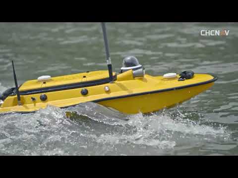
Coastal regions are among the most dynamic and challenging environments for infrastructure development. From ports and harbors to seawalls and offshore facilities, accurate data is essential for safe and efficient planning. How marine survey solutions Improve Coastal Infrastructure Planning is a key question for engineers, planners, and governments working to build resilient coastal systems.
Modern marine surveying technologies have transformed how underwater terrain, shoreline movement, and seabed conditions are understood. This article explores how these solutions support better decision-making, reduce risks, and enhance long-term infrastructure performance.
Understanding Marine Survey Solutions in Coastal Projects
Marine survey solutions involve the use of advanced equipment such as multibeam echo sounders, sonar systems, GNSS positioning, and remotely operated vehicles (ROVs) to map underwater environments. These tools help create highly accurate 3D models of seabeds, tidal zones, and coastal formations.
How Marine Survey Solutions Improve Coastal Infrastructure Planning becomes clear when we consider how traditional surveying methods often fail to capture the complexity of underwater landscapes. With modern tools, engineers can detect hazards like submerged rocks, sediment buildup, or erosion patterns before construction begins.
This level of precision ensures that projects such as bridges, ports, and coastal defenses are built on reliable data rather than assumptions.
Enhancing Accuracy in Coastal Mapping and Design
One of the biggest advantages of marine surveying is improved spatial accuracy. High-resolution bathymetric data allows planners to understand depth variations and underwater slopes in detail.
Better Decision-Making with Data-Driven Insights
By using real-time data collection systems, planners can simulate environmental impacts and optimize designs before breaking ground. This is a major reason How Marine Survey Solutions Improve Coastal Infrastructure Planning is often discussed in modern civil engineering projects.
Accurate mapping also helps reduce costly redesigns and construction delays, which are common in coastal environments due to unpredictable seabed conditions.
Reducing Risks in Coastal Construction Projects
Coastal infrastructure projects face unique risks such as storm surges, rising sea levels, and shifting sediments. Marine survey technologies help identify these risks early in the planning phase.
By analyzing seabed stability and coastal erosion patterns, engineers can design structures that are more resilient and adaptive to environmental changes.
In fact, How Marine Survey Solutions Improve Coastal Infrastructure Planning is closely linked to risk mitigation strategies used in sustainable coastal engineering. Early detection of unstable zones ensures that infrastructure is not placed in high-risk areas, reducing long-term maintenance costs and structural failures.
Supporting Sustainable and Environmentally Responsible Development
Environmental protection is a major concern in coastal development. Marine survey solutions help minimize ecological disruption by providing detailed insights into marine habitats and ecosystems.
Protecting Marine Life and Coastal Ecosystems
With precise data, planners can avoid sensitive habitats such as coral reefs, seagrass beds, and breeding grounds. This ensures that infrastructure development is balanced with environmental preservation.
Another important aspect of How Marine Survey Solutions Improve Coastal Infrastructure Planning is their role in monitoring environmental changes over time. Continuous surveying allows authorities to track erosion, sediment movement, and habitat shifts, supporting more sustainable long-term planning.
Improving Efficiency and Reducing Project Costs
Time and cost efficiency are critical in large-scale coastal projects. Marine survey solutions streamline the planning process by reducing the need for repeated site visits and manual data collection.
Digital models generated from survey data allow teams to collaborate remotely and make faster design adjustments. This reduces delays and improves coordination between engineers, contractors, and stakeholders.
Ultimately, How Marine Survey Solutions Improve Coastal Infrastructure Planning is also about optimizing resources. By improving accuracy and reducing uncertainty, these technologies help prevent expensive construction errors and redesigns.
The Future of Coastal Infrastructure Planning
As climate change continues to impact coastal regions, the importance of advanced marine surveying will only increase. Emerging technologies such as autonomous underwater vehicles (AUVs), AI-driven data analysis, and real-time monitoring systems are set to further revolutionize the field.
Future infrastructure projects will rely even more heavily on precise underwater data to ensure resilience and sustainability. In this evolving landscape, How Marine Survey Solutions Improve Coastal Infrastructure Planning will remain a central focus for engineers and decision-makers worldwide.
Conclusion
Marine survey technologies have become essential tools in modern coastal engineering. From improving accuracy and reducing risks to supporting sustainability and cost efficiency, their impact is undeniable. As coastal environments grow more complex and vulnerable, How Marine Survey Solutions Improve Coastal Infrastructure Planning continues to highlight the importance of data-driven decision-making in building safer and more resilient coastal infrastructure.
